
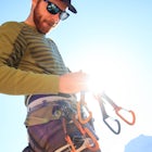
Jake YoungExplorer
Adventurer, Photographer, Impact Investor. I work with companies that want to have a positive impact on the world around them.

Alamere Falls via Palomarin Trailhead
Bolinas, California
4.5
13.54 mi
/ 1936 ft gain
Alamere Falls is the tallest waterfall in the bay area and makes for a very scenic Bolinas waterfall hike. It is known as a tide fall because it empties directly into the Pacific Ocean. This is extremely unique because there are only 34 tide falls in the world and two in California, the other being McWay Falls in Big Sur. Enjoy stunning views of the pacific combined with varying terrain throug...

Stanford Dish Loop
Stanford, California
4.4
3.67 mi
/ 472 ft gain
If you live in the Palo Alto area and are looking for a place to hike or run, The Dish is a close, and great way to get that exercise. Located right on the corner of Stanford Ave and Junipero Serra, you'll see that small gated entrance right when you drive on by. As far as parking goes, you're left with finding parking along Stanford Avenue or the elementary school lot further down the street. ...

Tomales Point Trail
Inverness, California
4.7
9.47 mi
/ 1165 ft gain
This hike will take you through the Tule Elk Preserve in Point Reyes Nation Seashore, and offers fantastic views of Bodega and Tomales Bay, as well as the Pacific Ocean.
Start at the Tomales Point Trailhead near the Historic Pierce Point Ranch. Follow the trail for roughly three miles. This trail is very well maintained and you are almost guaranteed to see tule elk along the way.
After reachi...

Camp at Fallen Leaf Lake
South Lake Tahoe, California
5.0
Fallen Leaf Lake is truly one of the more beautiful places in California. Separated from Lake Tahoe by just a one-mile strip of land, it feels worlds away from the crowds and fuss. The campground has over 200 sites that can be reserved here. There are endless hikes nearby including Mount Tallac and can these campsites can serve as a staging ground for backpacking trips into Desolation Wildernes...

Explore Lake Tahoe's Vikingsholm Castle
South Lake Tahoe, California
4.0
The drive to the location of Vikingsholm was beautiful with spectacular views of Lake Tahoe and Emerald Bay, when approached from South Lake Tahoe. The hike down the hill to see this gem was worth it but could be hard for some (because the only return is up this somewhat steep path with switchbacks). But this is a well preserved site and well worth the effort to make the climb. The extra cost t...

Glen Alpine Falls and Grass Lake
Tahoma, California
4.8
5.29 mi
/ 725 ft gain
Park your car at the Glen Alpine Trailhead adjacent to Lily Lake and southwest of Fallen Leaf Lake. Head west on Glen Alpine Creek Trail passing Lily Lake on your left. After a little over a mile and a half of trekking through the alpine forest and taking in mountain views, you'll arrive at Alpine Falls.
Break out the camera, get the kids ready, and start snapping the photo for the family hol...

Maggie's Peaks
South Lake Tahoe, California
5.0
3.85 mi
/ 1663 ft gain
This hike starts from the Bayviews Campground Trailhead. This day use area is usually pretty crowded so arrive early to get a parking spot. There is parking a quarter of a mile into the campground near the trail head, but if there is no room there is overflow parking just outside of the camping area. The trail starts with an option to go into Desolation Wilderness or Cascade Falls. Take the rig...

Summit Price & Agassiz from Desolation Wilderness
Twin Bridges, California
5.0
Mount Price (9,975') is the second highest summit in the Desolation Wilderness, standing just eight feet lower than Pyramid Peak to the south. In between these two peaks stands Mount Agassiz (9,967'), whose overhanging summit resembles a granite wave poised to crash down into the Desolation Valley nearly 2,000 feet below. Both Agassiz and Price offer fun scrambling and airy summits, and can b...

Explore the Alpine Lakes of Desolation Wilderness
Echo Lake, California
5.0
This incredible hike offers you the opportunity to visit the heart of desolation without climbing more than about 600 feet of elevation. Begin at the boat taxi at Lower Echo Lake. The taxi costs $12/person each way and is $5 each-way for your furry friend. The taxi leaves the dock at frequent intervals or as soon as there are 3 people ready to go. Once you're on the taxi, it will take you acros...

Hike to Half Moon Lake in Desolation Wilderness
Tahoma, California
5.0
11 mi
/ 1600 ft gain
This hike starts at the Glen Alpine Trailhead near Fallen Leaf Lake. Because Desolation is a wilderness area, you are required to fill out a day-use permit which can be found at the trailhead. If you are backpacking make sure to obtain an overnight permit either online or at the Taylor Creek Visitor Center.After you fill out your permit, start heading up the gravel road behind the gate. This ro...

Hike to Snow Lake in Desolation Wilderness
South Lake Tahoe, California
5.0
5 mi
This wonderful alpine lake is a relatively short hike in Desolation Wilderness and is a perfect introduction to off trail exploration. This area lacks the crowds that other lakes in Desolation garner because most maps don't show the trail leading to the lake. Although there is a rough trail, the ability to route find, read a topo and hike off trail are required to do this hike. This trail start...

Hike to Wapta Falls, Yoho National Park
Parson, British Columbia
5.0
2.4 mi
/ 180 ft gain
This short 1.2 mile hike leads you through a relatively level forest to a spot on the Kicking Horse River where the water crashes off a river-wide cliff, producing almost a guaranteed rainbow at the bottom. The trail starts at the Wapta Falls Trailhead, which is a short drive off the Trans Canadian Highway just south of Field.After gaining roughly 45 feet through a heavily forested area, the tr...

Hike the North Grove Trail in Calaveras Big Trees SP
Arnold, California
5.0
1.7 mi
/ 40 ft gain
When thinking of the iconic Sequoias of the Sierra Nevada, one usually thinks of Yosemite and Sequoia National Park. However, there is a often forgotten area of Giant Sierra Redwoods that gets far less traffic than the more popular groves. The North Grove Trail takes you through a grove of over 100 Giant Sequoias. The trail starts and ends in the North Grove Parking Lot. The trail is a relative...

Camp at Last Chance Creek Campground on Lake Almanor
Plumas County, CaliforniaThis PG&E campsite is located on the northern most inlet of Lake Almanor and is slightly more remote than the other sites around Lake Almanor. The campground offers spectacular views and easy access to great fishing. To get there, head east out of the town of Chester on Highway 36. After crossing the bridge take the first left onto a dirt road. The road is directly across from the entrance ...

Camp Under the Redwoods at Memorial Park
Loma Mar, CaliforniaWith old growth redwoods and a creek swimming area, Memorial Park is a perfect escape from the hustle and bustle of the Bay Area. Memorial Park is only a few miles east of the town of Pescadero. To get here, you can either approach from Highway 1 and drive up Pescadero Creek Road or take Highway 84 and turn onto Pescadero Creek Road shortly after the town of La Honda. There are two main camping...

Hike the South Grove Trail in Big Trees SP
Tuolumne County, California
3.7
5 mi
/ 560 ft gain
The South Grove Trail of Calaveras Big Trees State Park sees far less traffic than the North Grove due to its increased mileage and distance from the park entrance. The trail starts at the South Grove Trail head which is located nine miles east of the entrance on the main park road. The trailhead has bathrooms, but no running water. From the trailhead, head south for approximately 1.5 miles unt...

Cross-Country Ski the Big Hill Trails
Spearfish, South Dakota
13.6 mi
/ 300 ft gain
From Spearfish, head south on Tinton Rd. for roughly 8 miles. There will be a large parking lot to your right with a pit toilet and an information kiosk. The actual trail head is across the road from the parking lot. There are four different loops in the system all of varying difficulty and length. The Loops A, B, C and D are 2.6, 3.5, 6.9, and 7.5 respectively and can be combined for longer pu...
")
The Potholes ("The Pots")
Pioneer, California
4.2
1.53 mi
/ 121 ft gain
This fantastic camping or chilling spot has beautiful granite pools and slides of all sizes. The area consists of a river flowing over a granite slab creating pools some of which are over ten feet deep. The water cascades down the granite in small water falls. The area is located next to Silver Lake in Amador County just off of Highway 88.
If you are leaving from the Tahoe area, head southboun...

Hike to Little Devil's Tower in the Black Hills
Custer, South Dakota
5.0
The trail starts at the Little Devil's Tower Trailhead which is located roughly one mile east of Sylvan Lake on Highway 87. Take Trail #4 for around 1/2 mile until a fork in the trail. The right fork takes you to Harney Peak, while the left takes you to Little Devils Tower. Along the trail there are a few spur trails leading to granite overlooks. One can also explore the Noble Mica Mine which i...

Explore Deer Creek Falls
Tehama County, California
5.0
0.5 mi
This extremely short hike starts just off of Highway 32. From Chester, head southwest on 32 for roughly 21 miles. There is a turnout and a sign where the trail starts. This waterfall is best viewed in the spring when there is still a large amount of snow melt off. This waterfall is definitely not a destination hike, but is a perfect way to break up a longer drive on a hot summer day.

Hike through the Founder's Grove in Humboldt Redwoods State Park
Redcrest, California
5.0
1.3 mi
The Founder's Grove is easily accessed from Highway 101 in northern California. The grove is also on the Avenue of the Giants Scenic Highway. This area, named after the founders of the Save the Redwoods League, is flat and has a relatively open understory making it one of the most picturesque groves in California. The hike starts in the parking lot and meanders through the towering redwoods. Th...

Explore the Frozen Waterfalls of Spearfish Canyon
Spearfish, South Dakota
5.0
There are a multitude of frozen waterfalls throughout Spearfish Canyon. Some require a short hike and others can be seen from the road. This adventure will describe how to access the three largest frozen falls.Take Spearfish Canyon Highway south out of the town of Spearfish SD. After roughly 6 miles, there will be a pullout on your right and a small wooden deck on the other side of the street. ...

Canyon Rim Route
Pescadero, California
5.0
8.94 mi
/ 2070 ft gain
Located deep within the Santa Cruz Mountains, Butano State Park boasts a large redwood canyon with many miles of hiking trails as well as campsites. This state park is one of the quietest and least visited parks on the peninsula making a perfect place to escape the hustle of the Bay Area
Butano State Park is only accessible from the Pacific Coast Highway, also known as Highway One. If you are...

Ribbon Falls via North Kaibab Trailhead
North Rim, Arizona
5.0
17.57 mi
/ 7589 ft gain
Although this hike can feasibly done in a day, it is highly recommended that you spend more than one day in this area and visit the falls as a side trip on a larger trip. The closest campsites to Ribbon Falls are Cottonwood Campground and the Bright Angel Campground at Phantom Ranch.
Ribbon Falls is on the North Kaibab Trail which has a trailhead at the North Rim of the Grand Canyon. The trai...
Community
Mobile Apps

© 2025 The Outbound Collective - Terms of Use - Privacy Policy